
Virtual Public Art Map
Tour public art sites within Rochester, New Hampshire.
About
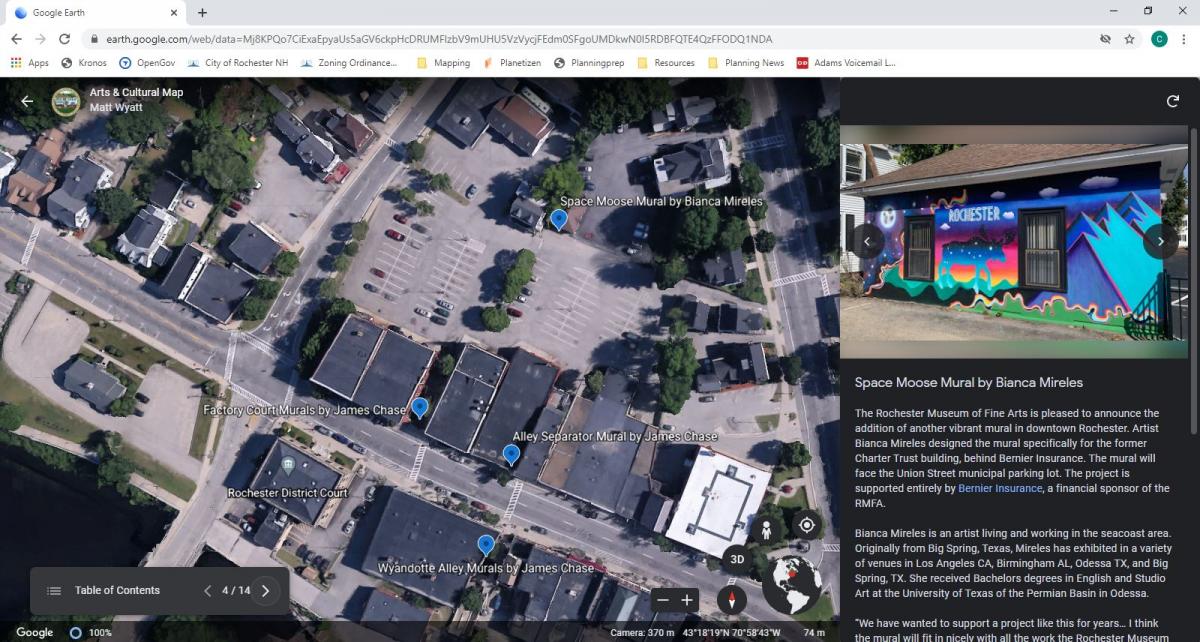
The Planning & Development Department and Public Information Office collaborated to catalog and upload art and cultural sites into Google Earth. The project is viewable on a desktop or via a mobile device.
Get Started
Users are encouraged to navigate between "pins" using the Table of Contents feature.
- Click here to explore the map on a desktop computer or mobile device.
- Mobile devices will prompt you to download the Google Earth app if you don't have it installed already. Google Earth is free and available on the iOS and Google app stores.
Preview
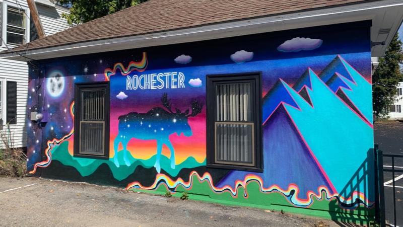
All photos are provided courtesy of the respective sponsors and organizations.
A Work in Progress
The Arts & Culture map is an evolving project. Additional photos and text will be uploaded as more projects are created. Check back frequently for updates. If you would like to contribute photos, please contact matthew.wyatt@rochesternh.net.